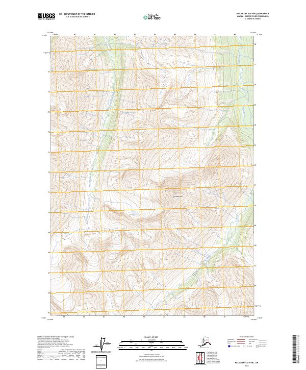
2023 Map of McCarthy A-6 SW
USGS Topo · Published 2023About this map
Goodlata Peak anchors the high terrain of this eastern Alaskan landscape, rising within the protected boundaries of the Wrangell-Saint Elias National Park. The topography is defined by the drainage systems of the Chakina River and its West Fork Chakina River, which carve deep valleys through the mountain ranges. This area remains largely untouched by development, as evidenced by its inclusion in the Wrangell-St Elias Wilderness. The map illustrates a primitive and unpopulated environment where natural landforms dictate the passage of water and the layout of the high-altitude terrain. Geographers and naturalists can trace the exact flow of the Chakina tributaries through this remote corner of the Copper River Census Area, observing how the glaciated history of the region shaped the current path of the rivers.
Find a feature on this map
9 named features on this map. Tap any name to fly to it.
Don’t see what you’re looking for? This feature index may not catch every label — zoom into the map to look around manually.
Map Details
Editions of this 2023 McCarthy A-6 SW Map
This is the sole edition of this map. No revisions or reprints were ever made.
Other maps of this area

1950 · Bering Glacier
USGS Topo · 1:250,000

1951 · McCarthy
USGS Topo · 1:250,000

1951 · Bering Glacier
USGS Topo · 1:250,000

1959 · McCarthy A-6
USGS Topo · 1:63,360

1959 · Bering Glacier
USGS Topo · 1:250,000

1959 · McCarthy A-7
USGS Topo · 1:63,360

1960 · McCarthy
USGS Topo · 1:250,000
1984 · Bering Glacier D-7
USGS Topo · 1:63,360
1984 · Bering Glacier D-6
USGS Topo · 1:63,360

1994 · McCarthy A-6
USGS Topo · 1:63,360