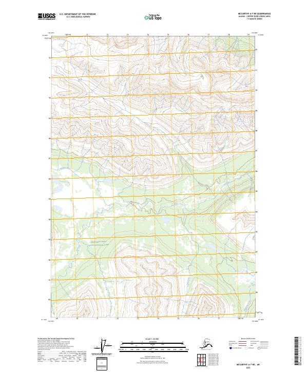
2023 Map of McCarthy A-7 NE
USGS Topo · Published 2023About this map
Wrangell-Saint Elias National Park encompasses this high-altitude Alaskan landscape, where the drainage systems of several distinct rivers and creeks intersect. The geography is defined by the flow of the Hanagita River across the central west and the Klu River through the heart of the Wrangell-St. Elias Wilderness. Unlike more developed regions, this area remains a study in natural hydrography, with smaller tributaries like Skull Creek in the north and Monahan Creek in the southeast carving through the terrain. The map provides a clear look at the protected status of these lands, showing the transition between the general national park boundaries and the more strictly regulated wilderness area. These federal designations highlight the region's preservation as a primitive environment without roads or permanent settlements.
Find a feature on this map
11 named features on this map. Tap any name to fly to it.
Don’t see what you’re looking for? This feature index may not catch every label — zoom into the map to look around manually.
Map Details
Editions of this 2023 McCarthy A-7 NE Map
This is the sole edition of this map. No revisions or reprints were ever made.
Other maps of this area

1951 · McCarthy
USGS Topo · 1:250,000

1959 · McCarthy B-6
USGS Topo · 1:63,360

1959 · McCarthy A-6
USGS Topo · 1:63,360

1959 · McCarthy A-7
USGS Topo · 1:63,360

1959 · McCarthy B-7
USGS Topo · 1:63,360

1960 · McCarthy
USGS Topo · 1:250,000

1994 · McCarthy A-6
USGS Topo · 1:63,360
1994 · McCarthy B-6
USGS Topo · 1:63,360
1995 · McCarthy B-7
USGS Topo · 1:63,360
2017 · McCarthy A-7 SW
USGS Topo · 1:25,000