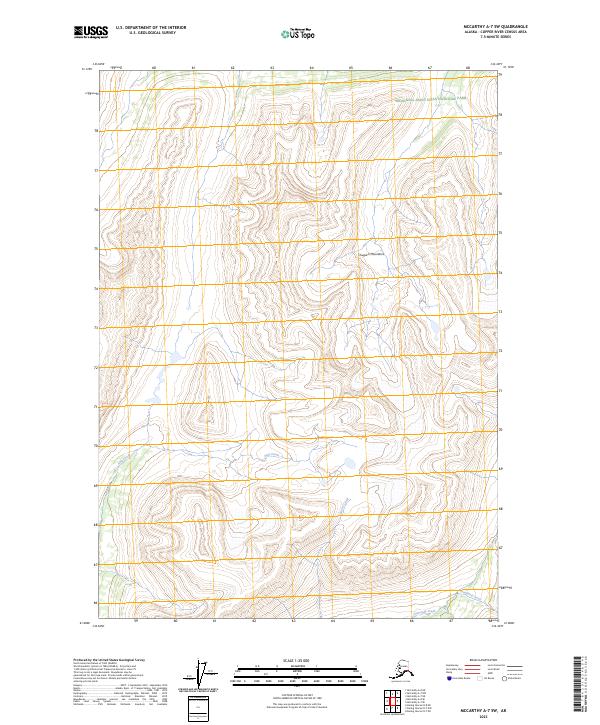
2023 Map of McCarthy A-7 SW
USGS Topo · Published 2023About this map
The Chugach Mountains dominate this high-elevation landscape within the Wrangell-Saint Elias National Park. This protected interior environment is defined by its drainage systems, where glacial and snowmelt runoff feed into named watercourses like Amy Creek and Shovel Creek in the western half of the quadrangle. In the southeast, the terrain falls toward Golconda Creek and Standard Creek, which trace the base of steep slopes within the Wrangell-St. Elias Wilderness. The map provides a precise contemporary view of this remote wilderness, showing the intricate contouring of the peaks and the vast reaches of the National Park System in Alaska. The absence of roads or permanent settlements highlights the primitive nature of this terrain, preserved for its ecological and geological significance.
Find a feature on this map
11 named features on this map. Tap any name to fly to it.
Don’t see what you’re looking for? This feature index may not catch every label — zoom into the map to look around manually.
Map Details
Editions of this 2023 McCarthy A-7 SW Map
This is the sole edition of this map. No revisions or reprints were ever made.
Other maps of this area

1950 · McCarthy A-8
USGS Topo · 1:63,360

1950 · Bering Glacier
USGS Topo · 1:250,000

1951 · McCarthy
USGS Topo · 1:250,000

1951 · Bering Glacier
USGS Topo · 1:250,000

1959 · Bering Glacier
USGS Topo · 1:250,000

1959 · McCarthy A-7
USGS Topo · 1:63,360

1960 · McCarthy
USGS Topo · 1:250,000
1984 · Bering Glacier D-7
USGS Topo · 1:63,360
1984 · Bering Glacier D-8
USGS Topo · 1:63,360
2014 · Bering Glacier D-7 NE
USGS Topo · 1:25,000