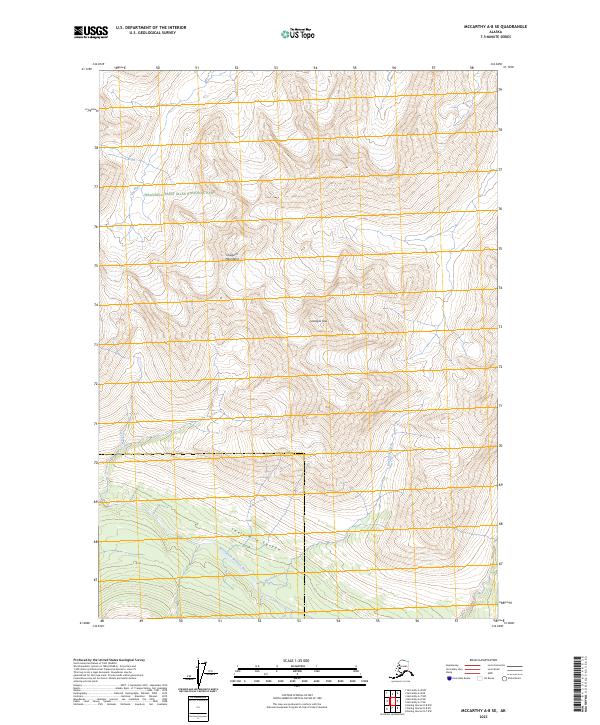
2023 Map of McCarthy A-8 SE
USGS Topo · Published 2023About this map
Hanagita Peak dominates this high-altitude landscape in the heart of the Chugach Mountains. The 2023 survey documents a remote wilderness environment within the Wrangell-St. Elias Wilderness and the broader Wrangell Saint Elias National Park. The terrain is defined by dramatic elevation changes, notably through Twelvemile Canyon where the North Fork Bremner River flows. This drainage system is fed by several tributaries including Blackrock Creek, Lost Creek, and the Klu River. The map primarily serves as a record of natural topography and hydrography in a region devoid of permanent human settlements or infrastructure, illustrating the undisturbed character of these interior Alaskan ranges.
Find a feature on this map
13 named features on this map. Tap any name to fly to it.
Don’t see what you’re looking for? This feature index may not catch every label — zoom into the map to look around manually.
Map Details
Editions of this 2023 McCarthy A-8 SE Map
This is the sole edition of this map. No revisions or reprints were ever made.
Other maps of this area

1950 · McCarthy A-8
USGS Topo · 1:63,360

1950 · Bering Glacier
USGS Topo · 1:250,000

1951 · McCarthy
USGS Topo · 1:250,000

1951 · Bering Glacier
USGS Topo · 1:250,000

1959 · Bering Glacier
USGS Topo · 1:250,000

1959 · McCarthy A-7
USGS Topo · 1:63,360

1960 · McCarthy
USGS Topo · 1:250,000
1984 · Bering Glacier D-7
USGS Topo · 1:63,360
1984 · Bering Glacier D-8
USGS Topo · 1:63,360
2016 · Bering Glacier D-7 NW
USGS Topo · 1:25,000