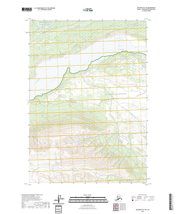
2023 Map of McCarthy B-7 SE
USGS Topo · Published 2023About this map
The Chitina River serves as the central geographic axis for this portion of the Alaskan interior, marking a transition between the Wrangell-Saint Elias National Preserve to the north and the expansive Wrangell-St. Elias Wilderness to the south. This modern survey illustrates the vast hydrographic network of the region, where the Lakina River joins the primary waterway and Steamboat Creek carves through the southern elevations. Human presence is concentrated along the historic McCarthy Road corridor in the northwestern corner, which provides the primary access point toward Crystal Lake and Crystal Creek. The map documents the meticulous preservation boundaries and the natural drainage patterns of this protected landscape, offering an essential reference for understanding the modern state of the Copper River Census Area's wilderness.
Find a feature on this map
13 named features on this map. Tap any name to fly to it.
Don’t see what you’re looking for? This feature index may not catch every label — zoom into the map to look around manually.
Map Details
Editions of this 2023 McCarthy B-7 SE Map
This is the sole edition of this map. No revisions or reprints were ever made.
Other maps of this area

1951 · McCarthy
USGS Topo · 1:250,000

1959 · McCarthy B-6
USGS Topo · 1:63,360

1959 · McCarthy A-6
USGS Topo · 1:63,360

1959 · McCarthy A-7
USGS Topo · 1:63,360

1959 · McCarthy B-7
USGS Topo · 1:63,360

1960 · McCarthy
USGS Topo · 1:250,000

1994 · McCarthy A-6
USGS Topo · 1:63,360
1994 · McCarthy B-6
USGS Topo · 1:63,360
1995 · McCarthy B-7
USGS Topo · 1:63,360
2017 · McCarthy B-7 SW
USGS Topo · 1:25,000