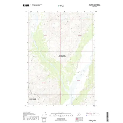
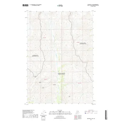
2017 Map of McCarthy C-5 SE
USGS Topo · Published 2017About this map
W Fork Glacier feeds a high-altitude drainage system in this portion of the Wrangell Mountains, where ice-melt carved the landscape of the Wrangell-Saint Elias National Park. The complex hydrology of the region is defined by the W Fork Nizina River and the West Fork Nizina River, which converge and flow toward the broad, braided channels of the Nizina River in the south. This survey illustrates the protected transition between the national park and the Wrangell-Saint Elias National Preserve. The terrain is dominated by significant elevations such as Nizina Mtn and the steep-walled canyon of Amphitheatre Cr, reflecting a wilderness defined by glacial recession and high-mountain runoff. Surveyed townships like t3s r15e and t4s r16e mark the administrative grid over this undeveloped Alaskan expanse.
Find a feature on this map
12 named features on this map. Tap any name to fly to it.
Don’t see what you’re looking for? This feature index may not catch every label — zoom into the map to look around manually.
Map Details
Editions of this 2017 McCarthy C-5 SE Map
This is the sole edition of this map. No revisions or reprints were ever made.
Other maps of this area

1951 · McCarthy
USGS Topo · 1:250,000

1959 · McCarthy C-5
USGS Topo · 1:63,360

1959 · McCarthy B-5
USGS Topo · 1:63,360

1959 · McCarthy C-4
USGS Topo · 1:63,360

1959 · McCarthy B-4
USGS Topo · 1:63,360

1960 · McCarthy
USGS Topo · 1:250,000
1993 · McCarthy C-4
USGS Topo · 1:63,360
1993 · McCarthy C-5
USGS Topo · 1:63,360
1994 · McCarthy B-4
USGS Topo · 1:63,360
2017 · McCarthy C-5 SW
USGS Topo · 1:25,000