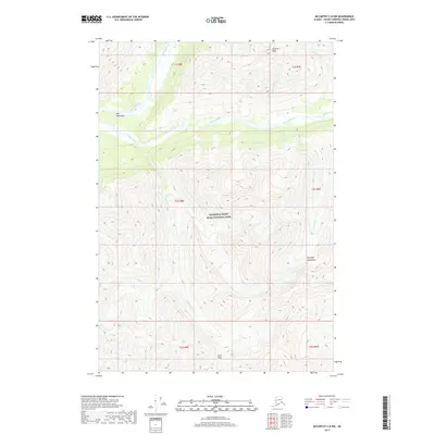
2017 Map of McCarthy C-8 NW
USGS Topo · Published 2017About this map
The Wrangell-Saint Elias National Park dominates this section of the Wrangell Mountains, where the landscape is defined by high-altitude drainages and dramatic elevation changes. The braided course of the Kotsina River flows through the central valley, joined by tributaries like Amy Cr and Roaring Cr. This area is characterized by significant topographic landmarks, most notably the towering Granite Peak and the high passage at Dixie Pass in the southern reaches of the quadrangle.
Find a feature on this map
22 named features on this map. Tap any name to fly to it.
Don’t see what you’re looking for? This feature index may not catch every label — zoom into the map to look around manually.
Map Details
Editions of this 2017 McCarthy C-8 NW Map
This is the sole edition of this map. No revisions or reprints were ever made.
Other maps of this area

1951 · McCarthy
USGS Topo · 1:250,000

1951 · McCarthy C-8
USGS Topo · 1:63,360

1951 · Valdez C-1
USGS Topo · 1:63,360

1952 · Valdez
USGS Topo · 1:250,000

1953 · Valdez C-1
USGS Topo · 1:63,360

1959 · Valdez D-1
USGS Topo · 1:63,360

1960 · McCarthy D-8
USGS Topo · 1:63,360

1960 · McCarthy
USGS Topo · 1:250,000

1960 · Valdez
USGS Topo · 1:250,000
1995 · McCarthy C-8
USGS Topo · 1:63,360