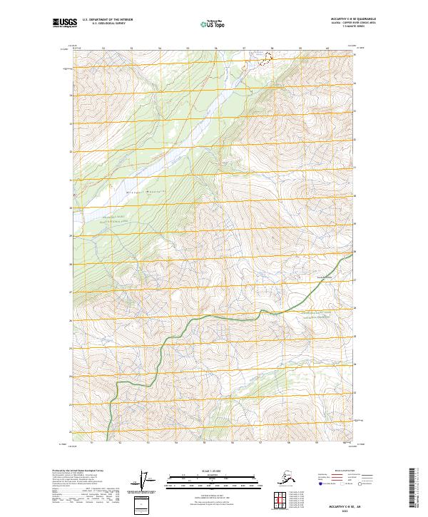
2023 Map of McCarthy C-8 SE
USGS Topo · Published 2023About this map
The Kuskulana Glacier feeds a network of glacial meltwater systems in this northern reach of the Wrangell Mountains. The landscape is dominated by high-altitude drainages, including the north-flowing Kuskulana River and its numerous tributaries such as Slatka Creek and Nugget Creek. These watercourses carve through complex terrain that includes Kuskulana Pass and ridges overlooking the Chokosna River to the south.
Find a feature on this map
21 named features on this map. Tap any name to fly to it.
Don’t see what you’re looking for? This feature index may not catch every label — zoom into the map to look around manually.
Map Details
Editions of this 2023 McCarthy C-8 SE Map
This is the sole edition of this map. No revisions or reprints were ever made.
Other maps of this area

1951 · McCarthy
USGS Topo · 1:250,000

1951 · McCarthy C-8
USGS Topo · 1:63,360

1951 · McCarthy B-8
USGS Topo · 1:63,360

1959 · McCarthy C-7
USGS Topo · 1:63,360

1959 · McCarthy B-7
USGS Topo · 1:63,360

1960 · McCarthy
USGS Topo · 1:250,000
1995 · McCarthy B-7
USGS Topo · 1:63,360

1995 · McCarthy B-8
USGS Topo · 1:63,360
1995 · McCarthy C-7
USGS Topo · 1:63,360
1995 · McCarthy C-8
USGS Topo · 1:63,360