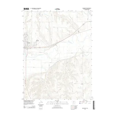
2014 Map of McCook East
USGS Topo · Published 2014About this map
McCook serves as the focal point of this Red Willow County landscape, where the confluence of aviation, agriculture, and hydrology defines the region's character. The Mc Cook Ben Nelson Regional Airport dominates the plateau north of the Republican River, while a complex network of irrigation infrastructure, including the Culbertson Extension Canal and Meeker Extension Canal, supports the surrounding plains. The terrain is marked by significant drainage systems such as Kelley Cr, Dry Cr, and Brushy Cr, which carve through the high ground towards the river valley.
Find a feature on this map
47 named features on this map. Tap any name to fly to it.
Don’t see what you’re looking for? This feature index may not catch every label — zoom into the map to look around manually.
Map Details
Editions of this 2014 McCook East Map
This is the sole edition of this map. No revisions or reprints were ever made.
Other maps of this area

1954 · McCook
USGS Topo · 1:250,000

1957 · McCook
USGS Topo · 1:250,000

1957 · McCook SW
USGS Topo · 1:24,000

1957 · Danbury
USGS Topo · 1:24,000

1957 · McCook SE
USGS Topo · 1:24,000

1958 · McCook
USGS Topo · 1:250,000
1958 · Indianola
USGS Topo · 1:24,000

1970 · Red Willow Dam
USGS Topo · 1:24,000

1970 · McCook West
USGS Topo · 1:24,000

1970 · Quick SE
USGS Topo · 1:24,000