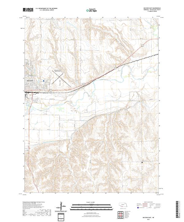
2021 Map of McCook East
USGS Topo · Published 2021About this map
The city of McCook and the surrounding plains of Red Willow County are defined by a complex network of water management and river geography. The Republican River serves as the primary drainage through the center of the sheet, supplemented by the Culbertson Extension Canal and Meeker-Extension Canal, which demonstrate the regional reliance on irrigation infrastructure. To the north, the terrain transitions into the distinct River Canyon and the winding path of Red Willow Cr. The eastern edge of the city is anchored by McCook Community College and the McCook Ben Nelson Regional Airport, while the outlying rural landscape includes the Saint John Cem. This map details the intersection of urban development and the hydraulic engineering required to sustain agricultural life in the Nebraska panhandle, tracing various smaller tributaries like Kelley Cr, Brushy Cr, and Dry Cr across the township lines.
Find a feature on this map
47 named features on this map. Tap any name to fly to it.
Don’t see what you’re looking for? This feature index may not catch every label — zoom into the map to look around manually.
Map Details
Editions of this 2021 McCook East Map
This is the sole edition of this map. No revisions or reprints were ever made.
Other maps of this area

1954 · McCook
USGS Topo · 1:250,000

1957 · McCook
USGS Topo · 1:250,000

1957 · McCook SW
USGS Topo · 1:24,000

1957 · Danbury
USGS Topo · 1:24,000

1957 · McCook SE
USGS Topo · 1:24,000

1958 · McCook
USGS Topo · 1:250,000
1958 · Indianola
USGS Topo · 1:24,000

1970 · Red Willow Dam
USGS Topo · 1:24,000

1970 · McCook West
USGS Topo · 1:24,000

1970 · Quick SE
USGS Topo · 1:24,000