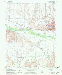
1970 Map of McCook West
USGS Topo · Published 1983About this map
Mc Cook serves as the focal point for this survey, showcasing the urban development of Red Willow County during the 1970s and early 1980s. The city's social infrastructure is well-defined, featuring the St Catherines Hosp, the Special Education Center, and several local campuses including Central Sch and North Ward Sch. Outside the city limits, the rural landscape is defined by the Republican River and a complex network of irrigation infrastructure such as the Meeker Driftwood Canal and West Driftwood Canal. This system of canals and siphons illustrates the intensive agricultural engineering required in the High Plains. To the west, the settlement of Perry sits along the Burlington Northern railroad, while numerous gravel pits and Sandpits mark the industrial activity along the river valley. Genealogists can find localized landmarks like Calvary Cem and remote country schools such as School No 23 and School No 16.
Find a feature on this map
43 named features on this map. Tap any name to fly to it.
Don’t see what you’re looking for? This feature index may not catch every label — zoom into the map to look around manually.
Map Details
Editions of this 1970 McCook West Map
2 editions found
Other maps of this area

1954 · McCook
USGS Topo · 1:250,000

1957 · McCook
USGS Topo · 1:250,000

1957 · McCook SW
USGS Topo · 1:24,000

1957 · McCook SE
USGS Topo · 1:24,000

1958 · McCook
USGS Topo · 1:250,000

1970 · Red Willow Dam
USGS Topo · 1:24,000
1970 · Culbertson
USGS Topo · 1:24,000

1970 · McCook West
USGS Topo · 1:24,000

1970 · Burger Canyon SE
USGS Topo · 1:24,000

1970 · Quick SE
USGS Topo · 1:24,000