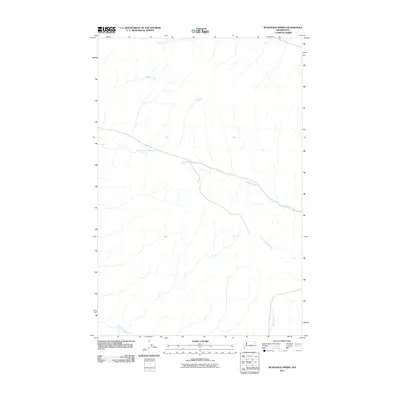
2011 Map of McDonald Spring
USGS Topo · Published 2011About this map
McDonald Spring stands as a central water source in this high-desert drainage system of Kittitas County. The landscape is defined by the dendritic patterns of several significant waterways, including the elongated course of Hanson Creek and the headwaters of the North Fork Lmuma Creek. These ephemeral and perennial streams suggest a topography shaped by seasonal runoff, providing vital resources for the ranching operations that have historically characterized this part of Washington. The convergence of Cottonwood Creek and the main branch of Lmuma Creek in the southern portion of the quadrangle illustrates the local hydrological network that supports the region's sparse but essential vegetation and livestock. This 2011 survey documents the persistent natural landmarks of the area, from the northern reaches of Foster Creek to the named springs that have likely served as navigational waypoints for generations.
Find a feature on this map
7 named features on this map. Tap any name to fly to it.
Don’t see what you’re looking for? This feature index may not catch every label — zoom into the map to look around manually.
Map Details
Editions of this 2011 McDonald Spring Map
This is the sole edition of this map. No revisions or reprints were ever made.
Other maps of this area

1936 · Yakima East
USGS Topo · 1:48,000

1936 · Hog Ranch Buttes
USGS Topo · 1:48,000

1938 · Badger Pocket
USGS Topo · 1:48,000

1939 · Boylston
USGS Topo · 1:48,000

1941 · Black Rock Spring
USGS Topo · 1:62,500

1941 · Yakima East
USGS Topo · 1:62,500

1943 · Boylston
USGS Topo · 1:62,500

1943 · Badger Pocket
USGS Topo · 1:62,500

1950 · Yakima
USGS Topo · 1:250,000

1953 · McDonald Spring
USGS Topo · 1:24,000