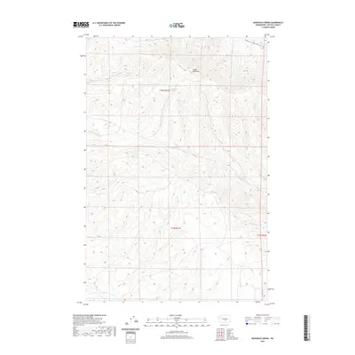
2020 Map of McDonald Spring
USGS Topo · Published 2020About this map
Saddle Mountains dominate the northern terrain of this Kittitas County region, where the ridge slopes descend into a network of intermittent drainages. The landscape is defined by the high-elevation ridges of the western plateau, cut by seasonal watercourses such as Foster Cr and Badger Cr. Central to the map is McDonald Spring, a critical water source in an otherwise arid environment. Along the northern border, the Palouse To Cascades State Park Trail follows a high-elevation corridor, marking a modern recreational use of the historic cross-state rail route. The southern portion of the quadrangle transitions into the drainage basins of Hanson Cr and Cottonwood Cr, eventually reaching the main stem of Lmuma Cr. This USGS survey illustrates the characteristic section-line grid system typical of Washington's inland plateaus, where land divisions are superimposed over significant topographic relief.
Find a feature on this map
13 named features on this map. Tap any name to fly to it.
Don’t see what you’re looking for? This feature index may not catch every label — zoom into the map to look around manually.
Map Details
Editions of this 2020 McDonald Spring Map
This is the sole edition of this map. No revisions or reprints were ever made.
Other maps of this area

1936 · Yakima East
USGS Topo · 1:48,000

1936 · Hog Ranch Buttes
USGS Topo · 1:48,000

1938 · Badger Pocket
USGS Topo · 1:48,000

1939 · Boylston
USGS Topo · 1:48,000

1941 · Black Rock Spring
USGS Topo · 1:62,500

1941 · Yakima East
USGS Topo · 1:62,500

1943 · Boylston
USGS Topo · 1:62,500

1943 · Badger Pocket
USGS Topo · 1:62,500

1950 · Yakima
USGS Topo · 1:250,000

1953 · McDonald Spring
USGS Topo · 1:24,000