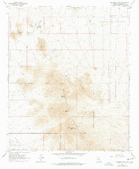
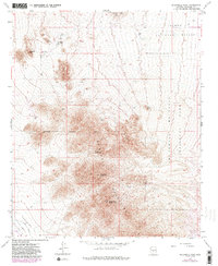
1965 Map of McDowell Peak
USGS Topo · Published 1977About this map
Mc Dowell Mountains dominate the center of this survey, standing as a formidable natural barrier between Paradise Valley and the eastern desert expanses. The map records the mid-1960s landscape of Maricopa County, highlighting early outposts like Reata Pass and the encroaching Scottsdale Corporate Boundary. Mining history is evidenced by the Dixie Mine and various unnamed prospects scattered along the mountain flanks, while water infrastructure like the Old Verde Canal and Mountain Spring point to the critical need for resource management in the arid terrain. Land use transitions are clear, showing the intersection of Tonto National Forest and the expanding Mc Dowell Mountain Regional Park. Distinctive summits including Mc Dowell Peak, Thompson Peak, and Pinnacle Peak provide significant relief against the alluvial plains, with a radio facility atop Thompson Peak marking modern technological footprints in the high desert.
Find a feature on this map
24 named features on this map. Tap any name to fly to it.
Don’t see what you’re looking for? This feature index may not catch every label — zoom into the map to look around manually.
Map Details
Editions of this 1965 McDowell Peak Map
6 editions found

Other maps of this area

1904 · Camelback
USGS Topo · 1:62,500

1904 · Ft. McDowell
USGS Topo · 1:62,500

1906 · Camelsback
USGS Topo · 1:62,500

1906 · Ft. McDowell
USGS Topo · 1:62,500

1930 · Cave Creek
USGS Topo · 1:125,000

1939 · Cave Creek
USGS Topo · 1:125,000

1954 · Mesa
USGS Topo · 1:250,000

1957 · Mesa
USGS Topo · 1:250,000

1958 · Mesa
USGS Topo · 1:250,000

1960 · Mesa
USGS Topo · 1:250,000
Featured Places
- Scottsdale, AZ
- Fountain Hills, AZ
- Maricopa County, AZ
- United States
- Pinnacle Peak Heights V-VI, Scottsdale