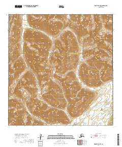
2019 Map of McGrath A-1 NE
USGS Topo · Published 2019About this map
Rainy Pass serves as a critical geographic gateway within the Teocalli Mountains on this 2019 survey, marking the boundary between the Yukon-Koyukuk and Bethel Census Areas. The landscape is defined by its complex drainage systems, where Pass Fork Dalzell Cr and the main Dalzell Cr carve through high-elevation terrain. To the south, the headwaters of the Happy River are joined by Sheep Cr and Puntilla Cr, illustrating the hydrographic divide of the Alaska Range.
Find a feature on this map
17 named features on this map. Tap any name to fly to it.
Don’t see what you’re looking for? This feature index may not catch every label — zoom into the map to look around manually.
Map Details
Editions of this 2019 McGrath A-1 NE Map
This is the sole edition of this map. No revisions or reprints were ever made.
Other maps of this area

1949 · McGrath
USGS Topo · 1:250,000

1950 · McGrath
USGS Topo · 1:250,000

1950 · Talkeetna
USGS Topo · 1:250,000

1951 · Talkeetna
USGS Topo · 1:250,000

1958 · Talkeetna A-6
USGS Topo · 1:63,360

1958 · Talkeetna B-6
USGS Topo · 1:63,360

1958 · McGrath B-1
USGS Topo · 1:63,360

1958 · McGrath A-1
USGS Topo · 1:63,360

1958 · Talkeetna
USGS Topo · 1:250,000

1958 · McGrath
USGS Topo · 1:250,000