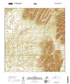
2019 Map of McGrath A-6 SW
USGS Topo · Published 2019About this map
The border between the Yukon-Koyukuk Census Area and the Bethel Census Area bisects this topographic landscape in the Alaska interior. The map reveals an area defined primarily by its natural relief and the Public Land Survey System grid, which is marked by township and range designations such as T24N R36W and T23N R36W. While the terrain is varied, the absence of developed road networks or named settlements highlights the persistent isolation of this remote region. The survey provides a clear view of the elevation contours that define the local drainages and ridges, illustrating the untouched character of the Alaskan wilderness as it was documented in the early twenty-first century.
Find a feature on this map
10 named features on this map. Tap any name to fly to it.
Don’t see what you’re looking for? This feature index may not catch every label — zoom into the map to look around manually.
Map Details
Editions of this 2019 McGrath A-6 SW Map
This is the sole edition of this map. No revisions or reprints were ever made.
Other maps of this area

1949 · McGrath
USGS Topo · 1:250,000

1950 · Sleetmute
USGS Topo · 1:250,000

1950 · McGrath
USGS Topo · 1:250,000

1951 · Lime Hills
USGS Topo · 1:250,000

1951 · Iditarod
USGS Topo · 1:250,000

1954 · Sleetmute D-1
USGS Topo · 1:63,360

1954 · Iditarod A-1
USGS Topo · 1:63,360
1954 · McGrath A-6
USGS Topo · 1:63,360
1954 · Lime Hills D-8
USGS Topo · 1:63,360

1954 · Sleetmute
USGS Topo · 1:250,000