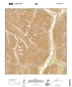
2019 Map of McGrath B-2 SE
USGS Topo · Published 2019About this map
The Alaska Range defines the high-altitude landscape of this interior terrain, where the Post River carves a deep valley through the eastern portion of the quadrangle. In this environment, water features such as Smith Lake in the northwest and the Post River drainage represent the primary landmarks in an otherwise roadless wilderness. The transition from the high peaks of the Terra Cotta Mountains to the lower river corridors highlights the stark elevation changes characteristic of the region. This 2019 survey provides a precise record of the natural hydrology and topography, capturing the undisturbed drainage patterns of the Post River before it flows toward larger systems.
Find a feature on this map
8 named features on this map. Tap any name to fly to it.
Don’t see what you’re looking for? This feature index may not catch every label — zoom into the map to look around manually.
Map Details
Editions of this 2019 McGrath B-2 SE Map
This is the sole edition of this map. No revisions or reprints were ever made.
Other maps of this area

1949 · McGrath
USGS Topo · 1:250,000

1950 · McGrath
USGS Topo · 1:250,000

1958 · McGrath B-1
USGS Topo · 1:63,360

1958 · McGrath A-2
USGS Topo · 1:63,360

1958 · McGrath A-1
USGS Topo · 1:63,360

1958 · McGrath B-2
USGS Topo · 1:63,360

1958 · McGrath
USGS Topo · 1:250,000
2019 · McGrath B-2 SW
USGS Topo · 1:25,000
2019 · McGrath B-2 NW
USGS Topo · 1:25,000
2019 · McGrath A-2 NW
USGS Topo · 1:25,000