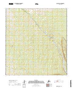
2019 Map of McGrath D-1 SE
USGS Topo · Published 2019About this map
The Little Tonzona River carves a central path through this subarctic terrain in the Yukon-Koyukuk region. In this part of the Alaska Interior, the hydrology is defined by the braided path of the river and the incoming waters of the Clear Fork. The map provides a look at the natural state of this drainage system before any major infrastructure, highlighting the complex network of mountain streams and topographic contours that dictate the flow toward the Tanana valley. This 2019 data captures the landscape at a point where traditional surveying boundaries like t32n r21w and t31n r20w meet the raw geographic reality of the river's winding course.
Find a feature on this map
6 named features on this map. Tap any name to fly to it.
Don’t see what you’re looking for? This feature index may not catch every label — zoom into the map to look around manually.
Map Details
Editions of this 2019 McGrath D-1 SE Map
This is the sole edition of this map. No revisions or reprints were ever made.
Other maps of this area

1949 · McGrath
USGS Topo · 1:250,000

1950 · McGrath
USGS Topo · 1:250,000

1950 · Talkeetna
USGS Topo · 1:250,000

1951 · Talkeetna
USGS Topo · 1:250,000

1958 · Talkeetna D-6
USGS Topo · 1:63,360

1958 · Talkeetna C-6
USGS Topo · 1:63,360

1958 · McGrath C-1
USGS Topo · 1:63,360

1958 · Talkeetna
USGS Topo · 1:250,000

1958 · McGrath D-1
USGS Topo · 1:63,360

1958 · McGrath
USGS Topo · 1:250,000