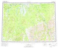
1958 Map of McGrath
USGS Topo · Published 1974About this map
The Kuskokwim River serves as the primary artery for transport and settlement in this Interior Alaska region, where the confluence of the Takotna River and Tatalina River supports the community of McGrath. The landscape is a network of river-based infrastructure, from the Big River Roadhouse to the remote river settlement at Vinasale. Toward the southeast, the terrain rises into the Alaska Range, marked by the Terra Cotta Mountains and notable high points like Egypt Mountain.
Find a feature on this map
73 named features on this map. Tap any name to fly to it.
Don’t see what you’re looking for? This feature index may not catch every label — zoom into the map to look around manually.
Map Details
Editions of this 1958 McGrath Map
3 editions found

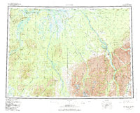
Other maps of this area

1949 · Tyonek
USGS Topo · 1:250,000

1949 · McGrath
USGS Topo · 1:250,000

1950 · Medfra
USGS Topo · 1:250,000

1950 · Sleetmute
USGS Topo · 1:250,000

1950 · McGrath
USGS Topo · 1:250,000

1950 · Talkeetna
USGS Topo · 1:250,000

1951 · Talkeetna
USGS Topo · 1:250,000

1951 · Ophir
USGS Topo · 1:250,000

1951 · Tyonek
USGS Topo · 1:250,000

1951 · Lime Hills
USGS Topo · 1:250,000