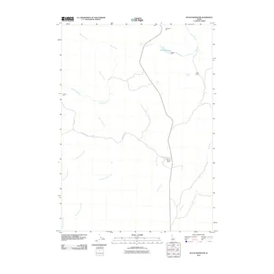
2010 Map of McHan Reservoir
USGS Topo · Published 2010About this map
McHan Reservoir and its namesake McHan Dam dominate the upper drainage of this high-desert Idaho landscape, where water management is the primary driver of the terrain's utility. The drainage network is complex, featuring McHan Reservoir fed by Spring Creek and the long course of Schooler Creek winding through the center of the sheet. Notable landmarks like Flat Top Butte and Johnson Hill rise above the drainage systems of Black Canyon Creek and Thorn Creek.
Find a feature on this map
19 named features on this map. Tap any name to fly to it.
Don’t see what you’re looking for? This feature index may not catch every label — zoom into the map to look around manually.
Map Details
Editions of this 2010 McHan Reservoir Map
This is the sole edition of this map. No revisions or reprints were ever made.
Other maps of this area

1955 · Hailey
USGS Topo · 1:250,000

1957 · Fairfield
USGS Topo · 1:62,500

1957 · Thorn Creek SE
USGS Topo · 1:24,000

1957 · Thorn Creek SW
USGS Topo · 1:24,000

1957 · Thorn Creek
USGS Topo · 1:62,500

1957 · Davis Mountain
USGS Topo · 1:62,500

1957 · Blaine
USGS Topo · 1:62,500

1959 · Hailey
USGS Topo · 1:250,000

1962 · Hailey
USGS Topo · 1:250,000
1986 · Thorn Creek Reservoir
USGS Topo · 1:24,000