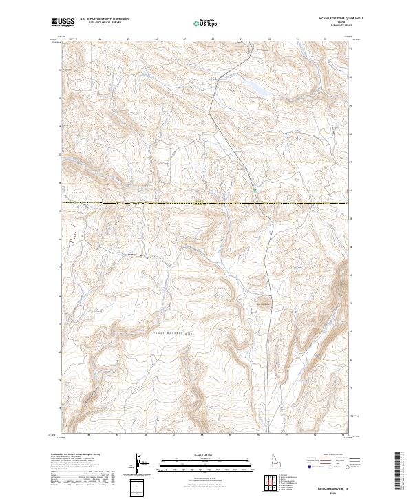
2024 Map of McHan Reservoir
USGS Topo · Published 2024About this map
The Mount Bennett Hills dominate the southern portion of this landscape, where the Camas Co Gooding Co line divides the high-country drainage basins. The area is defined by a dense network of seasonal and perennial waters, including the headwaters of Spring Creek and McKinney Creek in the north, and the deep incisions of Black Canyon Creek and Thorn Creek to the south. Historically significant water sources like Bull Spring, Hash Spring, and Gwin Spring are scattered across the terrain, indicating the vital importance of reliable water in this high-desert environment. Notable landmarks such as Flat Top Butte and Johnson Hill provide vertical relief above Burnt Willow Canyon and Long Gulch. The sparse road network, centered on Fir Grove Rd, highlights the remote character of this region on the border of Camas and Gooding counties.
Find a feature on this map
22 named features on this map. Tap any name to fly to it.
Don’t see what you’re looking for? This feature index may not catch every label — zoom into the map to look around manually.
Map Details
Editions of this 2024 McHan Reservoir Map
This is the sole edition of this map. No revisions or reprints were ever made.
Other maps of this area

1955 · Hailey
USGS Topo · 1:250,000

1957 · Fairfield
USGS Topo · 1:62,500

1957 · Thorn Creek SE
USGS Topo · 1:24,000

1957 · Thorn Creek SW
USGS Topo · 1:24,000

1957 · Thorn Creek
USGS Topo · 1:62,500

1957 · Davis Mountain
USGS Topo · 1:62,500

1957 · Blaine
USGS Topo · 1:62,500

1959 · Hailey
USGS Topo · 1:250,000

1962 · Hailey
USGS Topo · 1:250,000
1986 · Thorn Creek Reservoir
USGS Topo · 1:24,000