
1953 Map of McIntosh
USGS Topo · Published 1965About this map
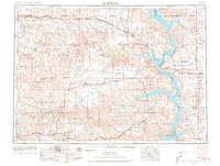
The Standing Rock Indian Reservation and Cheyenne River Indian Reservation dominate this landscape of the north-central Dakotas, as it appeared in the mid-1950s. The Missouri River is seen here transformed into the Oah E Reservoir, a major structural shift that redefined the eastern edge of the region. This period shows the Chicago Milwaukee St Paul and Pacific railroad threading through dozens of prairie settlements, from the regional hub of Mobridge to smaller stops like Watauga and Mahto.
Find a feature on this map
87 named features on this map. Tap any name to fly to it.
Don’t see what you’re looking for? This feature index may not catch every label — zoom into the map to look around manually.
Map Details
Editions of this 1953 McIntosh Map
3 editions found
Other maps of this area

1951 · Ridgeview NW
USGS Topo · 1:24,000

1951 · Redelm NE
USGS Topo · 1:24,000

1951 · Virginia
USGS Topo · 1:24,000

1951 · Dupree NE
USGS Topo · 1:24,000

1951 · Ridgeview NE
USGS Topo · 1:24,000

1951 · Redelm NW
USGS Topo · 1:24,000

1951 · Faith NE
USGS Topo · 1:24,000

1951 · Thunder Butte
USGS Topo · 1:24,000

1951 · La Plant
USGS Topo · 1:24,000

1951 · Promise
USGS Topo · 1:24,000