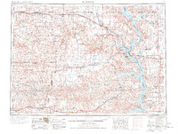
1953 Map of McIntosh
USGS Topo · Published 1977About this map
The Standing Rock Indian Reservation and Cheyenne River Indian Reservation dominate this landscape during a period of significant hydrological change. The Missouri River corridor, shown here as the developing Lake Oahe, reflects the impacts of mid-century dam projects on tribal lands and riverfront settlements like Mobridge. The Chicago Milwaukee St Paul and Pacific railroad cuts across the northern plains, anchoring a line of cattle-shipping towns including McIntosh, McLaughlin, and Morristown. To the south, the rail line through Isabel and Timber Lake serves the more fragmented terrain of the Cheyenne River drainage. The map preserves the locations of numerous family-named landmarks and isolated resources, such as the Keller Mine and Little Moreau St Pk, alongside traditional indigenous place names like Iron Lightning and Little Eagle. This survey captures the transition from open range to the modern era of regulated water and state-managed recreation.
Find a feature on this map
96 named features on this map. Tap any name to fly to it.
Don’t see what you’re looking for? This feature index may not catch every label — zoom into the map to look around manually.
Map Details
Editions of this 1953 McIntosh Map
3 editions found

Other maps of this area

1951 · Ridgeview NW
USGS Topo · 1:24,000

1951 · Redelm NE
USGS Topo · 1:24,000

1951 · Virginia
USGS Topo · 1:24,000

1951 · Dupree NE
USGS Topo · 1:24,000

1951 · Ridgeview NE
USGS Topo · 1:24,000

1951 · Redelm NW
USGS Topo · 1:24,000

1951 · Faith NE
USGS Topo · 1:24,000

1951 · Thunder Butte
USGS Topo · 1:24,000

1951 · La Plant
USGS Topo · 1:24,000

1951 · Promise
USGS Topo · 1:24,000