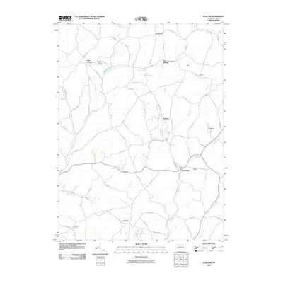
2010 Map of McIntyre
USGS Topo · Published 2010About this map
Blacklegs Creek and Aultmans Run carve through the landscape of Indiana County, anchoring a network of small settlements and rural crossroads. The area is defined by its mining and postal history, centered on communities like McIntyre and the nearby Clune Post Office. Local history is deeply embedded in the terrain at sites such as West Lebanon Cemetery and Union Cemetery, while the village of Jacksonville marks a key junction where the Kent Post Office once served the surrounding residents. Smaller locales like Lewisville and Aultman are connected by a web of local roads including Saltsburg Rd and Old Route 56 Hwy W, reflecting a mid-century pattern of coal-country development and agrarian persistence. The map also features several prominent water bodies such as Green Valley Lake and various runs that define the watershed of the region.
Find a feature on this map
85 named features on this map. Tap any name to fly to it.
Don’t see what you’re looking for? This feature index may not catch every label — zoom into the map to look around manually.
Map Details
Editions of this 2010 McIntyre Map
This is the sole edition of this map. No revisions or reprints were ever made.
Other maps of this area

1900 · Latrobe
USGS Topo · 1:62,500

1902 · Latrobe
USGS Topo · 1:62,500

1902 · Indiana
USGS Topo · 1:62,500

1902 · Elders Ridge
USGS Topo · 1:62,500

1903 · Latrobe
USGS Topo · 1:62,500

1904 · Elders Ridge
USGS Topo · 1:62,500

1920 · New Florence
USGS Topo · 1:62,500

1921 · New Florence
USGS Topo · 1:48,000

1922 · New Florence
USGS Topo · 1:62,500

1944 · New Florence
USGS Topo · 1:62,500
Featured Places
- Black Lick Township, PA
- South Bend Township, PA
- Armstrong Township, PA
- Lewisville, Conemaugh Township
- Young Township, PA