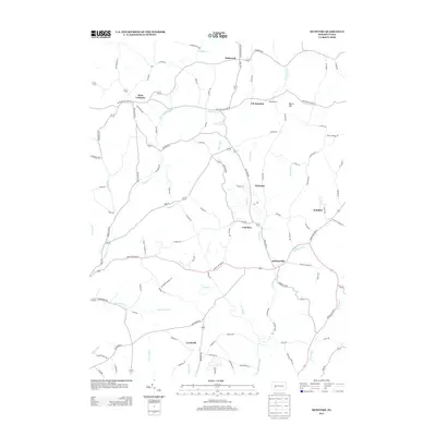
2013 Map of McIntyre
USGS Topo · Published 2013About this map
McIntyre and Coal Run anchor the central portion of this Indiana County landscape, reflecting the region's industrial ties to the coal fields of western Pennsylvania. The drainage patterns of Blacklegs Cr and Aultmans Run dictate the placement of roads and small settlements like Jacksonville and Aultman. Local history is visible in the naming of rural junctions and peaks, such as J M Junction and Watts Hill, which highlight the importance of specific family holdings and rail connections in shaping the early geography of Black Lick Township. Further west, West Lebanon and Lewisville serve as primary hubs within a network of named hollows and runs, including Dogwood Hollow Dr and Marshall Run. The presence of Green Valley Lake and numerous creeks like Whisky Run illustrates the water-rich topography that supported the area's agricultural and mining development.
Find a feature on this map
101 named features on this map. Tap any name to fly to it.
Don’t see what you’re looking for? This feature index may not catch every label — zoom into the map to look around manually.
Map Details
Editions of this 2013 McIntyre Map
This is the sole edition of this map. No revisions or reprints were ever made.
Other maps of this area

1900 · Latrobe
USGS Topo · 1:62,500

1902 · Latrobe
USGS Topo · 1:62,500

1902 · Indiana
USGS Topo · 1:62,500

1902 · Elders Ridge
USGS Topo · 1:62,500

1903 · Latrobe
USGS Topo · 1:62,500

1904 · Elders Ridge
USGS Topo · 1:62,500

1920 · New Florence
USGS Topo · 1:62,500

1921 · New Florence
USGS Topo · 1:48,000

1922 · New Florence
USGS Topo · 1:62,500

1944 · New Florence
USGS Topo · 1:62,500
Featured Places
- Black Lick Township, PA
- South Bend Township, PA
- Armstrong Township, PA
- Lewisville, Conemaugh Township
- Young Township, PA