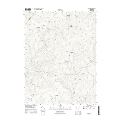
2016 Map of McIntyre
USGS Topo · Published 2016About this map
McIntyre and Jacksonville sit at the center of this rural Pennsylvania landscape, where the topography is defined by the winding paths of Blacklegs Cr and Aultmans Run. The area reflects a classic Appalachian settlement pattern, with small communities and family cemeteries like Union Cem and McIntyre Cem tucked between the ridges. The northern reaches near Parkwood and J M Junction are crisscrossed by a network of local routes such as Old Rte 56 W and Parkwood Rd, connecting the scattered farmsteads to the larger townships. To the west, the boundary between Armstrong and Indiana counties follows the high ground above Whiskey Run and Marshall Run. The presence of Green Valley Lake and numerous named runs highlights the importance of the local watershed in shaping the development of West Lebanon and Lewisville south towards the banks of Roaring Run.
Find a feature on this map
110 named features on this map. Tap any name to fly to it.
Don’t see what you’re looking for? This feature index may not catch every label — zoom into the map to look around manually.
Map Details
Editions of this 2016 McIntyre Map
This is the sole edition of this map. No revisions or reprints were ever made.
Other maps of this area

1900 · Latrobe
USGS Topo · 1:62,500

1902 · Latrobe
USGS Topo · 1:62,500

1902 · Indiana
USGS Topo · 1:62,500

1902 · Elders Ridge
USGS Topo · 1:62,500

1903 · Latrobe
USGS Topo · 1:62,500

1904 · Elders Ridge
USGS Topo · 1:62,500

1920 · New Florence
USGS Topo · 1:62,500

1921 · New Florence
USGS Topo · 1:48,000

1922 · New Florence
USGS Topo · 1:62,500

1944 · New Florence
USGS Topo · 1:62,500
Featured Places
- Black Lick Township, PA
- South Bend Township, PA
- Armstrong Township, PA
- Lewisville, Conemaugh Township
- Young Township, PA