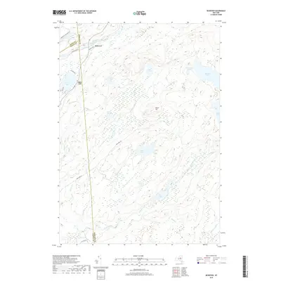
2019 Map of McKeever
USGS Topo · Published 2019About this map
McKeever and Otter Lake stand as the primary gateways to this remote portion of the Adirondack Park Preserve, where the Moose River defines the northern landscape near the border of Lewis and Oneida Counties. This area is characterized by an intricate network of wetlands and high-altitude water bodies, ranging from the expansive Woodhull Lake and Sand Lake in the east to smaller, isolated features like Bloodsucker Pond and Granny Marsh.
Find a feature on this map
37 named features on this map. Tap any name to fly to it.
Don’t see what you’re looking for? This feature index may not catch every label — zoom into the map to look around manually.
Map Details
Editions of this 2019 McKeever Map
This is the sole edition of this map. No revisions or reprints were ever made.
Other maps of this area

1897 · Remsen
USGS Topo · 1:62,500

1900 · Remsen
USGS Topo · 1:62,500

1900 · Wilmurt
USGS Topo · 1:62,500

1901 · Old Forge
USGS Topo · 1:62,500

1902 · Wilmurt
USGS Topo · 1:62,500

1912 · Mc Keever
USGS Topo · 1:62,500

1945 · Forestport
USGS Topo · 1:24,000
1946 · North Wilmurt
USGS Topo · 1:24,000
1947 · North Wilmurt
USGS Topo · 1:31,680
1947 · Forestport
USGS Topo · 1:31,680