
1975 Map of McKenzie
USGS Topo · Published 1975About this map
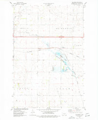
Mc Kenzie serves as a small rail and road hub in Burleigh County, shown here through an orthophotographic lens that reveals the intricate mosaic of North Dakota agriculture. The landscape is defined by its rectilinear fields, which are occasionally interrupted by the winding paths of Apple Creek and Random Creek. These waterways provide a stark visual contrast to the rigid geometry of the surrounding wheat and sunflower fields, following erratic courses through the prairie. The 1970s infrastructure is clearly visible, with the interstate corridor and local section lines carving the plains into distinct blocks. This aerial perspective captures the town at a moment when it functioned as a vital collection point for the surrounding farmsteads, grounded by its position along the Northern Pacific rail line and major highway routes.
Find a feature on this map
4 named features on this map. Tap any name to fly to it.
Don’t see what you’re looking for? This feature index may not catch every label — zoom into the map to look around manually.
Map Details
Editions of this 1975 McKenzie Map
2 editions found
Other maps of this area

1907 · Bismarck
USGS Topo · 1:125,000

1951 · Menoken
USGS Topo · 1:62,500

1951 · McKenzie
USGS Topo · 1:62,500

1954 · Bismarck
USGS Topo · 1:250,000

1958 · Bismarck
USGS Topo · 1:250,000

1971 · Huff NE
USGS Topo · 1:24,000

1971 · Moffit NW
USGS Topo · 1:24,000

1971 · Moffit
USGS Topo · 1:24,000

1975 · Sibley Butte
USGS Topo · 1:24,000

1975 · Sterling
USGS Topo · 1:24,000