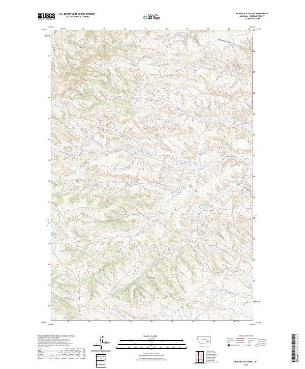
2024 Map of McKerlich Creek
USGS Topo · Published 2024About this map
McKerlich Creek and its surrounding drainage systems define this section of Rosebud County, where the topography is shaped by a dense network of coulees and seasonal waterways. The landscape is characterized by the complex branching of Cottonwood Creek, including its North Fork and South Fork tributaries. A prominent natural landmark, Castle Rock, stands out against the undulating terrain in the southern portion of the quadrangle.
Find a feature on this map
15 named features on this map. Tap any name to fly to it.
Don’t see what you’re looking for? This feature index may not catch every label — zoom into the map to look around manually.
Map Details
Editions of this 2024 McKerlich Creek Map
This is the sole edition of this map. No revisions or reprints were ever made.
Other maps of this area

1954 · Hardin
USGS Topo · 1:250,000

1954 · Forsyth
USGS Topo · 1:250,000

1957 · Hardin
USGS Topo · 1:250,000

1957 · Forsyth
USGS Topo · 1:250,000

1958 · Forsyth
USGS Topo · 1:250,000

1958 · Hardin
USGS Topo · 1:250,000

1971 · Hammond Draw NW
USGS Topo · 1:24,000

1971 · Colstrip East
USGS Topo · 1:24,000

1971 · Smith Creek NE
USGS Topo · 1:24,000
1971 · Colstrip West
USGS Topo · 1:24,000