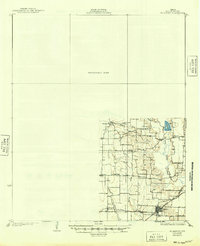
1929 Map of McKinney
USGS Topo · Published 1949About this map
The St. Louis Southwestern and the Gulf Colorado and Santa Fe railroads intersect at Wylie, forming a critical transportation hub in southern Collin County during the mid-1920s. This survey, conducted by R.H.Reineck and G.E.Sisson, reveals a landscape defined by small rural school districts and tight-knit agricultural settlements. The eastern portion of the map is dominated by the winding path of the East Fork Trinity River and several creek systems including White Rock Creek and Muddy Creek.
Find a feature on this map
21 named features on this map. Tap any name to fly to it.
Don’t see what you’re looking for? This feature index may not catch every label — zoom into the map to look around manually.
Map Details
Editions of this 1929 McKinney Map
2 editions found
Other maps of this area

1891 · Dallas
USGS Topo · 1:125,000

1893 · Dallas
USGS Topo · 1:125,000

1912 · Rockwall
USGS Topo · 1:31,680

1919 · Royse City
USGS Topo · 1:62,500

1924 · Farmersville 3-c
USGS Topo · 1:48,000

1924 · Mc Kinney 4-d
USGS Topo · 1:48,000

1929 · Frisco
USGS Topo · 1:62,500

1929 · McKinney
USGS Topo · 1:62,500

1930 · Farmersville
USGS Topo · 1:62,500

1931 · Carrollton
USGS Topo · 1:62,500