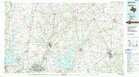
1985 Map of McKinney
USGS Topo · Published 1991About this map
McKinney and its surrounding North Texas neighbors are defined by an intricate network of waterways and early rail infrastructure in the mid-1980s. The landscape is carved by the East Fork Trinity River, Isle du Bois Creek, and Sister Grove Creek, providing a natural framework for the rural settlements of Westminster, Anna, and Celina. Significant industrial and transportation markers include the St Louis Southwestern RR and various stretches of Old Railroad Grade, which speak to the area's transition from 19th-century rail dependence to modern connectivity.
Find a feature on this map
170 named features on this map. Tap any name to fly to it.
Don’t see what you’re looking for? This feature index may not catch every label — zoom into the map to look around manually.
Map Details
Editions of this 1985 McKinney Map
2 editions found
Other maps of this area

1891 · Dallas
USGS Topo · 1:125,000

1893 · Dallas
USGS Topo · 1:125,000

1894 · Fort Worth
USGS Topo · 1:125,000

1901 · Denison
USGS Topo · 1:125,000

1902 · Gainesville
USGS Topo · 1:125,000

1903 · Paris
USGS Topo · 1:125,000

1912 · Rockwall
USGS Topo · 1:31,680

1919 · Royse City
USGS Topo · 1:62,500

1924 · Farmersville 3-c
USGS Topo · 1:48,000

1924 · Mc Kinney 4-d
USGS Topo · 1:48,000