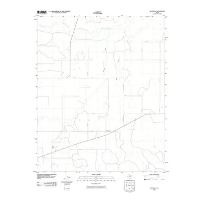
2010 Map of McKnight
USGS Topo · Published 2010About this map
McKnight serves as the central point of interest in this Donley County landscape, situated where local roads like Co RD U and Co RD T converge in the eastern Texas Panhandle. The area is defined by the drainage systems that feed into the Salt Fork Red River, which meanders across the northern portion of the quadrangle alongside Whitefish Creek. The terrain is marked by distinct seasonal watercourses such as Oklahoma Draw and Jesse Arroyo, illustrating the characteristic erosional patterns of the High Plains transition. To the southwest, Hedley Airport provides a modern aviation landmark, while the network of county roads, including County Line Road 5, delineates the grid of agricultural landholdings that have sustained the region for generations. This map captures the intersection of rural transport and the natural hydrology of the Panhandle before 21st-century shifts in land use and water management further altered the plains.
Find a feature on this map
20 named features on this map. Tap any name to fly to it.
Don’t see what you’re looking for? This feature index may not catch every label — zoom into the map to look around manually.
Map Details
Editions of this 2010 McKnight Map
This is the sole edition of this map. No revisions or reprints were ever made.
Other maps of this area

1954 · Amarillo
USGS Topo · 1:250,000

1954 · Plainview
USGS Topo · 1:250,000

1958 · Amarillo
USGS Topo · 1:250,000

1958 · Plainview
USGS Topo · 1:250,000

1959 · Lelia Lake Creek
USGS Topo · 1:24,000

1959 · Troublesome Creek
USGS Topo · 1:24,000

1959 · Spencer Lake
USGS Topo · 1:24,000

1959 · McKnight
USGS Topo · 1:24,000

1963 · Hedley
USGS Topo · 1:24,000

1963 · Giles
USGS Topo · 1:24,000