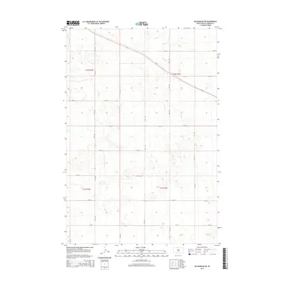
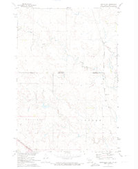
2015 Map of McLaughlin SW
USGS Topo · Published 2015About this map
The grid-iron layout of the Great Plains is etched into the landscape of Corson County, defined by a series of precise east-west thoroughfares including 106th St and 107th St. This area of South Dakota exhibits the classic Public Land Survey System structure, where north-south section lines like 256th Ave and 257th Ave dictate the movement of both people and agriculture. The landscape is primarily shaped by gentle topographic shifts, with the roads following a rigid geometry regardless of the undulating terrain beneath them. This 2015 study highlights the enduring nature of the section-line road network, a fundamental element of rural infrastructure that has organized the region since its early settlement. The isolation of these routes, from 110th St down to 113th St, reflects a sparsely populated agricultural environment where distance is measured by the mile-square section.
Find a feature on this map
18 named features on this map. Tap any name to fly to it.
Don’t see what you’re looking for? This feature index may not catch every label — zoom into the map to look around manually.
Map Details
Editions of this 2015 McLaughlin SW Map
This is the sole edition of this map. No revisions or reprints were ever made.
Other maps of this area

1953 · McIntosh
USGS Topo · 1:250,000
1956 · Little Eagle
USGS Topo · 1:24,000
1956 · Bullhead
USGS Topo · 1:24,000
1956 · Little Eagle NW
USGS Topo · 1:24,000
1956 · Miscol NE
USGS Topo · 1:24,000

1958 · McIntosh
USGS Topo · 1:250,000
1966 · McLaughlin
USGS Topo · 1:24,000
1966 · McLaughlin NE
USGS Topo · 1:24,000
1971 · McLaughlin SW
USGS Topo · 1:24,000
1971 · Maple Leaf
USGS Topo · 1:24,000