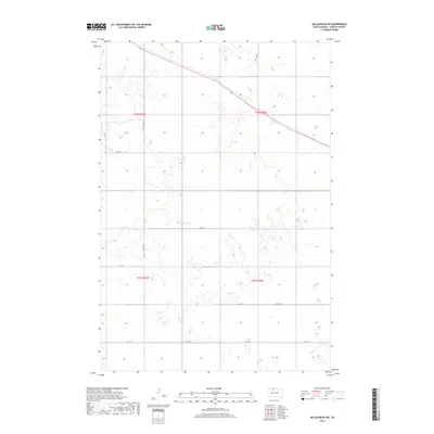
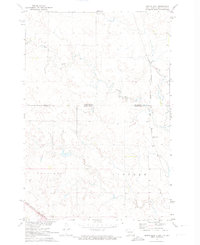
2017 Map of McLaughlin SW
USGS Topo · Published 2017About this map
The northern Great Plains landscape of Corson County is defined by its rigorous Public Land Survey System grid, which structures the movement across this rural expanse. A sparse network of gravel roads and section lines provides access to the undulating terrain, with Co Rd 13-1 serving as a primary corridor through the northern sections. The map reveals the township and range divisions, specifically t22n r25e, t22n r26e, t21n r25e, and t21n r26e, which organize the homesteading history and current land management in this part of South Dakota. Local travel is facilitated by a series of numbered routes including 257th Ave and 110th St, which trace the high ground and drainages typical of the region's topography. This document serves as a detailed guide to the road placements and surveyed boundaries as they existed in the early 21st century.
Find a feature on this map
13 named features on this map. Tap any name to fly to it.
Don’t see what you’re looking for? This feature index may not catch every label — zoom into the map to look around manually.
Map Details
Editions of this 2017 McLaughlin SW Map
This is the sole edition of this map. No revisions or reprints were ever made.
Other maps of this area

1953 · McIntosh
USGS Topo · 1:250,000
1956 · Little Eagle
USGS Topo · 1:24,000
1956 · Bullhead
USGS Topo · 1:24,000
1956 · Little Eagle NW
USGS Topo · 1:24,000
1956 · Miscol NE
USGS Topo · 1:24,000

1958 · McIntosh
USGS Topo · 1:250,000
1966 · McLaughlin
USGS Topo · 1:24,000
1966 · McLaughlin NE
USGS Topo · 1:24,000
1971 · McLaughlin SW
USGS Topo · 1:24,000
1971 · Maple Leaf
USGS Topo · 1:24,000