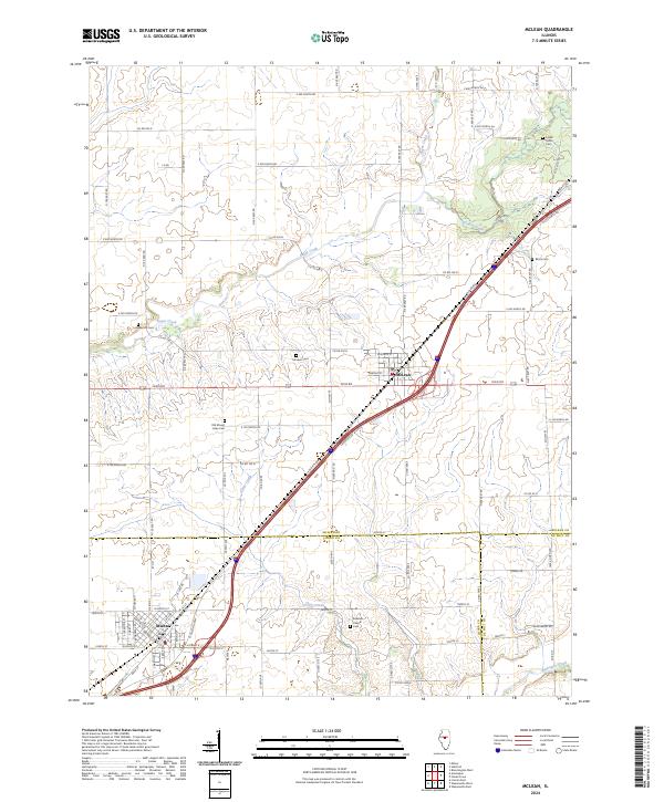
2024 Map of McLean
USGS Topo · Published 2024About this map
The agrarian landscape of central Illinois is documented here where the borders of McLean, Logan, and De Witt counties converge. The town of McLean serves as a central hub, flanked by the residential blocks of Atlanta to the southwest. This area is heavily defined by its small-town cemeteries, providing a significant resource for genealogical research. Sites such as Funks Grove Cem, Old Mount Hope Cem, and McLean Cem are scattered across the township, often situated near the winding courses of Sugar Creek and Timber Creek.
Find a feature on this map
45 named features on this map. Tap any name to fly to it.
Don’t see what you’re looking for? This feature index may not catch every label — zoom into the map to look around manually.
Map Details
Editions of this 2024 McLean Map
This is the sole edition of this map. No revisions or reprints were ever made.
Other maps of this area

1911 · Lincoln
USGS Topo · 1:62,500

1913 · Lincoln
USGS Topo · 1:62,500

1949 · Mc Lean
USGS Topo · 1:62,500

1951 · McLean
USGS Topo · 1:62,500

1951 · Minier
USGS Topo · 1:62,500

1957 · Kenney
USGS Topo · 1:62,500

1958 · Peoria
USGS Topo · 1:250,000

1961 · Peoria
USGS Topo · 1:250,000

1963 · Peoria
USGS Topo · 1:250,000

1980 · Armington
USGS Topo · 1:24,000