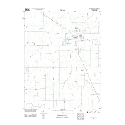
2012 Map of McLeansboro
USGS Topo · Published 2012About this map
McLeansboro serves as the focal point of this Southern Illinois landscape, where the confluence of several creeks including Tenmile Cr, Bear Cr, and Contrary Cr defines the local topography. The town's layout is marked by its central Po and proximity to the Mc Leansboro Airport and McLeansboro Junction. To the west, the smaller settlement of Diamond City sits along the roadway, while the Dale Oil Field to the southeast indicates the importance of regional resource extraction. Local family history is preserved through a high density of small burial sites and memorial grounds, such as the Independent Order of Oddfellows Cem and Knights Prairie Cem, reflecting a legacy of rural community life in Hamilton County.
Find a feature on this map
81 named features on this map. Tap any name to fly to it.
Don’t see what you’re looking for? This feature index may not catch every label — zoom into the map to look around manually.
Map Details
Editions of this 2012 McLeansboro Map
This is the sole edition of this map. No revisions or reprints were ever made.
Other maps of this area

1905 · Eldorado
USGS Topo · 1:62,500

1906 · Eldorado
USGS Topo · 1:62,500

1908 · Galatia
USGS Topo · 1:62,500

1938 · Galatia
USGS Topo · 1:62,500

1941 · Enfield
USGS Topo · 1:62,500

1942 · McLeansboro
USGS Topo · 1:62,500

1944 · Enfield
USGS Topo · 1:62,500

1945 · McLeansboro
USGS Topo · 1:62,500

1949 · Paducah
USGS Topo · 1:250,000

1950 · Paducah
USGS Topo · 1:250,000