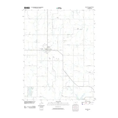
2010 Map of McLouth
USGS Topo · Published 2010About this map
McLouth serves as the central hub of this Jefferson County landscape, characterized by a well-defined grid of rural roads and the branching tributaries of the Kansas River basin. The town site is concentrated around the McLouth Post Office, with local aviation represented by the nearby Threshing Bee Airport. Outside the primary settlement, the land is divided by numerous waterways, including the winding Ninemile Creek and Fall Creek, which shape the local topography. This era of the landscape shows significant residential development around Lake Dabanawa in the southwest, contrasting with the more traditional rural patterns seen near the Brown School and Fowler Cemetery. The presence of roads such as Ragtown Rd and Lovers Ln provides a glimpse into the local naming conventions and historical pathing that defined the community at the start of the 21st century.
Find a feature on this map
51 named features on this map. Tap any name to fly to it.
Don’t see what you’re looking for? This feature index may not catch every label — zoom into the map to look around manually.
Map Details
Editions of this 2010 McLouth Map
This is the sole edition of this map. No revisions or reprints were ever made.
Other maps of this area

1886 · Oskaloosa
USGS Topo · 1:125,000

1888 · Oskaloosa
USGS Topo · 1:125,000

1894 · Oskaloosa
USGS Topo · 1:125,000

1948 · Jarbalo
USGS Topo · 1:24,000

1949 · Williamstown
USGS Topo · 1:24,000

1950 · Kansas City
USGS Topo · 1:250,000

1950 · Easton
USGS Topo · 1:24,000

1950 · Williamstown
USGS Topo · 1:24,000
1950 · Jarbalo
USGS Topo · 1:24,000
1950 · Midland
USGS Topo · 1:24,000