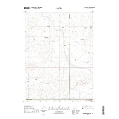
2017 Map of McPherson Springs
USGS Topo · Published 2017About this map
McPherson Springs and the surrounding high-desert terrain of the Wyoming-Colorado border reveal a landscape defined by seasonal water management and historic stock movement. The presence of the Shell Creek Stock Trl and the Poison Buttes Rd underscores the area's importance for cattle and sheep ranching, where remote outposts like Hartt Cabin Draw served early settlers. The complex network of dry-land features, such as Clay Flat Reservoir, Anthill Reservoir, and Dry Reservoir, illustrates the precarious nature of water in this arid stretch of Sweetwater County. In the south, the terrain drops toward the Little Snake River as it crosses the state line, carving through the Cherokee Rim. This topography, dotted with distinctive landmarks like Hangout Wash and the Lower Soap Holes, remains a critical study in how geography dictated the expansion of western grazing routes.
Find a feature on this map
32 named features on this map. Tap any name to fly to it.
Don’t see what you’re looking for? This feature index may not catch every label — zoom into the map to look around manually.
Map Details
Editions of this 2017 McPherson Springs Map
This is the sole edition of this map. No revisions or reprints were ever made.
Other maps of this area

1916 · Craig
USGS Topo · 1:125,000

1954 · Vernal
USGS Topo · 1:250,000

1954 · Rawlins
USGS Topo · 1:250,000

1954 · Rock Springs
USGS Topo · 1:250,000

1954 · Craig
USGS Topo · 1:250,000

1957 · Craig
USGS Topo · 1:250,000

1958 · Rawlins
USGS Topo · 1:250,000

1958 · Vernal
USGS Topo · 1:250,000

1958 · Rock Springs
USGS Topo · 1:250,000

1958 · Craig
USGS Topo · 1:250,000