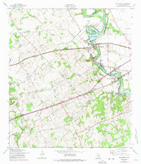
1958 Map of McQueeney
USGS Topo · Published 1975About this map
The Guadalupe River carves a winding path through this central Texas landscape, creating a recreational and industrial corridor anchored by Lake Mc Queeney and Lake Placid. By the mid-1950s, the area had developed into a leisure destination, evidenced by the Lake Breeze Ski Lodge and the residential layout of Treasure Island. These modern developments contrast with the older agricultural and transit roots of the region, where the Southern Pacific railroad served rural stops like Hilda Siding.
Find a feature on this map
24 named features on this map. Tap any name to fly to it.
Don’t see what you’re looking for? This feature index may not catch every label — zoom into the map to look around manually.
Map Details
Editions of this 1958 McQueeney Map
3 editions found
Other maps of this area

1911 · San Marcos
USGS Topo · 1:125,000

1919 · San Marcos
USGS Topo · 1:125,000

1920 · Smiley
USGS Topo · 1:125,000

1924 · New Braunfels No 4
USGS Topo · 1:48,000

1924 · San Marcos 3-c
USGS Topo · 1:48,000

1925 · New Braunfels No 1
USGS Topo · 1:48,000

1927 · New Braunfels
USGS Topo · 1:62,500

1930 · Seguin
USGS Topo · 1:62,500

1942 · Dewville
USGS Topo · 1:62,500

1953 · Seguin
USGS Topo · 1:250,000