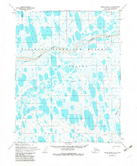
1955 Map of Meade River C-2
USGS Topo · Published 1983About this map
The National Petroleum Reserve in Alaska dominates this 1955 survey of the North Slope, revealing a landscape defined by thousands of small lakes and the winding course of the Meade River. This remote Arctic territory is shown shortly after the peak of mid-century exploration, as evidenced by a single Drill Hole located in the central tundra. The transport network of the time relied entirely on seasonal accessibility, marked by a Winter Trail and several Tractor Trails that cross the thawing ground to connect with the Okpiksak River. These routes underscore the logistical challenges of resource exploration in an era before permanent roads reached this far north.
Find a feature on this map
7 named features on this map. Tap any name to fly to it.
Don’t see what you’re looking for? This feature index may not catch every label — zoom into the map to look around manually.
Map Details
Editions of this 1955 Meade River C-2 Map
2 editions found
Other maps of this area

1951 · Meade River
USGS Topo · 1:250,000

1955 · Meade River
USGS Topo · 1:250,000

1955 · Meade River B-1
USGS Topo · 1:63,360

1955 · Meade River B-3
USGS Topo · 1:63,360

1955 · Meade River B-2
USGS Topo · 1:63,360

1955 · Meade River C-1
USGS Topo · 1:63,360

1955 · Meade River D-2
USGS Topo · 1:63,360

1955 · Meade River C-3
USGS Topo · 1:63,360

1955 · Meade River D-3
USGS Topo · 1:63,360
1955 · Meade River C-2
USGS Topo · 1:63,360