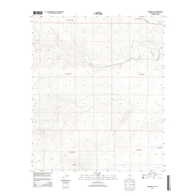
2013 Map of Meadow Hill
USGS Topo · Published 2013About this map
Rio Penasco winds across this section of Chaves County, defining a landscape of canyons and draws in the high plains. This 2013 survey illustrates the drainage patterns of the Bluewater Cr as it feeds toward the larger valley, with the namesake Meadow Hill rising in the southwestern portion of the quadrangle. The map details the remote road network including Rio Penasco Rd and Helena Rd, which provide access through the complex topography. To the southeast, the terrain opens into Walnut Draw, reflecting the arid hydrology of the region. This document captures the intersection of public land survey boundaries, such as t17s r18e and t17s r19e, across a sparsely populated but geographically distinct part of New Mexico.
Find a feature on this map
12 named features on this map. Tap any name to fly to it.
Don’t see what you’re looking for? This feature index may not catch every label — zoom into the map to look around manually.
Map Details
Editions of this 2013 Meadow Hill Map
This is the sole edition of this map. No revisions or reprints were ever made.
Other maps of this area

1954 · Carlsbad
USGS Topo · 1:250,000

1958 · Carlsbad
USGS Topo · 1:250,000

1960 · Teel Ranch
USGS Topo · 1:62,500

1962 · Dunken
USGS Topo · 1:62,500

1965 · Lewis Peak NE
USGS Topo · 1:24,000

1965 · Lewis Peak
USGS Topo · 1:24,000

1978 · Encino Draw
USGS Topo · 1:24,000

1978 · Artesia
USGS Topo · 1:100,000

1979 · Alamogordo
USGS Topo · 1:100,000
1989 · Sixteenmile Draw West
USGS Topo · 1:24,000