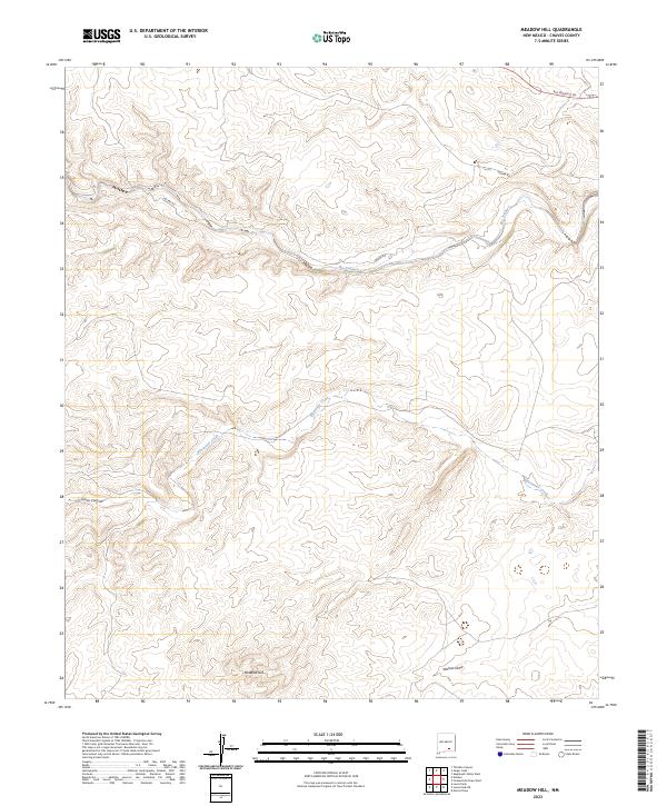
2023 Map of Meadow Hill
USGS Topo · Published 2023About this map
Rio Peñasco meanders through the northern reaches of this landscape, defining a critical drainage pattern in a region where water dictated the pulse of livestock ranching and travel. This modern 2023 survey provides a clear view of the high-desert topography in Chaves County, where the dry channel of Bluewater Creek cuts across the central townships before its confluence further east. The area is defined by sharp elevation changes, particularly around Meadow Hill and the deep incision of Cuevo Canyon in the southwest. A single major terrestrial artery, Helena Rd, traverses the northern sections, connecting the remote draws and basins. The mapping includes detailed Township and Range boundaries, serving as a reliable reference for identifying current land parcels and the persisting natural landmarks like Walnut Draw that have long served as navigation points in the New Mexico interior.
Find a feature on this map
13 named features on this map. Tap any name to fly to it.
Don’t see what you’re looking for? This feature index may not catch every label — zoom into the map to look around manually.
Map Details
Editions of this 2023 Meadow Hill Map
This is the sole edition of this map. No revisions or reprints were ever made.
Other maps of this area

1954 · Carlsbad
USGS Topo · 1:250,000

1958 · Carlsbad
USGS Topo · 1:250,000

1960 · Teel Ranch
USGS Topo · 1:62,500

1962 · Dunken
USGS Topo · 1:62,500

1965 · Lewis Peak NE
USGS Topo · 1:24,000

1965 · Lewis Peak
USGS Topo · 1:24,000

1978 · Encino Draw
USGS Topo · 1:24,000

1978 · Artesia
USGS Topo · 1:100,000

1979 · Alamogordo
USGS Topo · 1:100,000
1989 · Sixteenmile Draw West
USGS Topo · 1:24,000