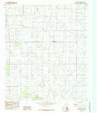
1985 Map of Meadow SE
USGS Topo · Published 1985About this map
The High Plains landscape along the Terry Co and Lynn Co line is defined by its deep agricultural and resource-extraction footprint as recorded in this 1980s-era study. The small settlement of Lakeview stands as the primary community node in an area otherwise characterized by a dense grid of thousands of wells, reflecting the region's intensive groundwater and oil-and-gas development. The terrain is largely level, though it is punctuated by subtle elevation changes such as the prominent Bluff 3294. This survey offers a precise record of the human modification of the Llano Estacado, where the repetition of labels reveals the scale of subsurface industry that has historically powered the local economy.
Find a feature on this map
4 named features on this map. Tap any name to fly to it.
Don’t see what you’re looking for? This feature index may not catch every label — zoom into the map to look around manually.
Map Details
Editions of this 1985 Meadow SE Map
This is the sole edition of this map. No revisions or reprints were ever made.
Other maps of this area

1954 · Lubbock
USGS Topo · 1:250,000

1954 · Brownfield
USGS Topo · 1:250,000

1957 · New Home
USGS Topo · 1:62,500

1957 · Meadow
USGS Topo · 1:62,500

1958 · Brownfield
USGS Topo · 1:250,000

1962 · Brownfield
USGS Topo · 1:250,000

1969 · Brownfield East
USGS Topo · 1:24,000

1969 · Mound Lake
USGS Topo · 1:24,000

1969 · Double Lakes
USGS Topo · 1:24,000

1976 · New Home NW
USGS Topo · 1:24,000