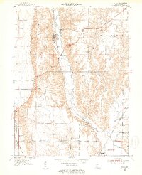
1951 Map of Mecca
USGS Topo · Published 1953About this map
Raccoon Creek and its tributary valleys define the landscape of this western Indiana survey, where industrial activity and rural settlements meet. The town of Mecca serves as a focal point, showing a cluster of Kilns that highlight the area's history with clay and brick production. The map captures a high density of early 1950s infrastructure, from the Roseville Sch in Coxville to the numerous family and community burial grounds like Hixon Cem and Union Cem.
Find a feature on this map
28 named features on this map. Tap any name to fly to it.
Don’t see what you’re looking for? This feature index may not catch every label — zoom into the map to look around manually.
Map Details
Editions of this 1951 Mecca Map
2 editions found
Other maps of this area

1950 · Rosedale
USGS Topo · 1:24,000

1950 · Brazil West
USGS Topo · 1:24,000

1950 · New Goshen
USGS Topo · 1:24,000

1951 · Clinton
USGS Topo · 1:24,000

1951 · Mecca
USGS Topo · 1:24,000

1952 · Catlin
USGS Topo · 1:24,000

1953 · Indianapolis
USGS Topo · 1:250,000

1955 · Rockville
USGS Topo · 1:24,000

1955 · Montezuma
USGS Topo · 1:24,000

1955 · Dana
USGS Topo · 1:24,000