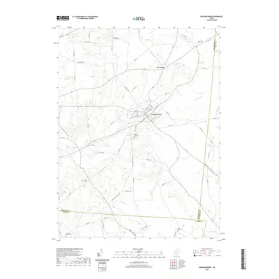
2019 Map of Mechanicsburg
USGS Topo · Published 2019About this map
Mechanicsburg serves as the central hub of this Champaign County landscape, where the street grid fans out from the intersection of W Main St, S Main St, and W Sandusky St. The surrounding countryside is defined by an intricate network of waterways, including Little Darby Cr and Clover Run, which drain the agricultural lands toward the south and east. Notable for genealogists and local historians are the numerous small burial grounds that dot the township lines, such as Maple Grove Cem just south of the village and the remote Nation Chapel Cem near the border of Madison County. The map also captures the outlying hamlets of Five Points and Catawba, illustrating the persistent rural settlement pattern of the region. Natural water features like Baker Lake and Fudger Lake provide distinct geographic anchors in a terrain otherwise characterized by steady stream-cut valleys and well-established township roads.
Find a feature on this map
54 named features on this map. Tap any name to fly to it.
Don’t see what you’re looking for? This feature index may not catch every label — zoom into the map to look around manually.
Map Details
Editions of this 2019 Mechanicsburg Map
This is the sole edition of this map. No revisions or reprints were ever made.
Other maps of this area

1907 · London
USGS Topo · 1:62,500

1907 · South Charleston
USGS Topo · 1:62,500

1914 · Mechanicsburg
USGS Topo · 1:62,500

1916 · Mechanicsburg
USGS Topo · 1:62,500

1916 · Milford Center
USGS Topo · 1:62,500

1944 · Mechanicsburg
USGS Topo · 1:62,500

1944 · Milford Center
USGS Topo · 1:62,500

1947 · Columbus
USGS Topo · 1:250,000

1950 · Marion
USGS Topo · 1:250,000

1961 · Columbus
USGS Topo · 1:250,000