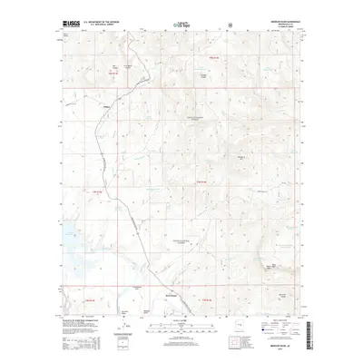
2014 Map of Meddler Wash
USGS Topo · Published 2014About this map
Theodore Roosevelt Lake and the Salt River anchor the southern reaches of this landscape, where the Salt River Valley meets the rising elevations of the Sierra Ancha. The area is characterized by a network of drainage systems including Griffin Wash, Meddler Wash, and Walnut Cr, which carve through the high desert. Small settlements and residential clusters such as Willow, Cottonwood Acre, and Rock House are situated along the Globe-Young Highway, reflecting the modern infrastructure and rural development patterns within the Tonto National Forest.
Find a feature on this map
47 named features on this map. Tap any name to fly to it.
Don’t see what you’re looking for? This feature index may not catch every label — zoom into the map to look around manually.
Map Details
Editions of this 2014 Meddler Wash Map
This is the sole edition of this map. No revisions or reprints were ever made.
Other maps of this area

1907 · Roosevelt
USGS Topo · 1:125,000

1909 · Four Peaks
USGS Topo · 1:125,000

1912 · Roosevelt
USGS Topo · 1:125,000

1922 · Chrysotile
USGS Topo · 1:125,000

1949 · McFadden Peak
USGS Topo · 1:62,500

1949 · Rockinstraw Mtn
USGS Topo · 1:62,500

1950 · Rockinstraw Mtn
USGS Topo · 1:62,500

1950 · McFadden Peak
USGS Topo · 1:62,500

1954 · Mesa
USGS Topo · 1:250,000

1957 · Mesa
USGS Topo · 1:250,000