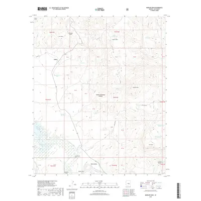
2018 Map of Meddler Wash
USGS Topo · Published 2018About this map
Willow sits at the northern end of this section of the Tonto National Forest, where the high desert meets the dramatic drainages of the Sierra Ancha. The landscape is defined by the hydrologic network feeding into Theodore Roosevelt Lake, visible at Campaign Bay. The Salt River carves through the southern terrain, creating the wide Salt River Valley and the steep Salt River Canyon. Named for the primary drainage, Meddler Wash flows toward the river near Meddler Point. Small settlements like Cottonwood Acre and Rock House are situated near the riverbanks, reflecting the importance of water access in Gila County. The map details numerous livestock tanks and springs, such as Roadrunner Tank and Tin Shack Spring, which supported ranching across the rugged elevations of Hackberry Mtn and Black Mesa.
Find a feature on this map
55 named features on this map. Tap any name to fly to it.
Don’t see what you’re looking for? This feature index may not catch every label — zoom into the map to look around manually.
Map Details
Editions of this 2018 Meddler Wash Map
This is the sole edition of this map. No revisions or reprints were ever made.
Other maps of this area

1907 · Roosevelt
USGS Topo · 1:125,000

1909 · Four Peaks
USGS Topo · 1:125,000

1912 · Roosevelt
USGS Topo · 1:125,000

1922 · Chrysotile
USGS Topo · 1:125,000

1949 · McFadden Peak
USGS Topo · 1:62,500

1949 · Rockinstraw Mtn
USGS Topo · 1:62,500

1950 · Rockinstraw Mtn
USGS Topo · 1:62,500

1950 · McFadden Peak
USGS Topo · 1:62,500

1954 · Mesa
USGS Topo · 1:250,000

1957 · Mesa
USGS Topo · 1:250,000