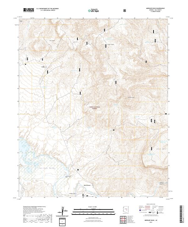
2021 Map of Meddler Wash
USGS Topo · Published 2021About this map
Theodore Roosevelt Lake dominates the southwestern corner of this topographic study, where the Salt River winds through the expansive Salt River Valley. This portion of the Tonto National Forest is defined by a complex network of canyons and mesas, with Sierra Ancha rising in the northwest and Black Mesa standing to the southeast. The landscape is dotted with essential water resources for this arid environment, ranging from natural springs like Willow Spring and Hackberry Spring to numerous cattle tanks including Oak Cr Tank and Chalk Tank. Small settlements and named locales such as Willow, Cottonwood Acre, and Rock House provide evidence of local habitation and land use amidst the rugged drainage systems of Meddler Wash and First Water Canyon.
Find a feature on this map
85 named features on this map. Tap any name to fly to it.
Don’t see what you’re looking for? This feature index may not catch every label — zoom into the map to look around manually.
Map Details
Editions of this 2021 Meddler Wash Map
This is the sole edition of this map. No revisions or reprints were ever made.
Other maps of this area

1907 · Roosevelt
USGS Topo · 1:125,000

1909 · Four Peaks
USGS Topo · 1:125,000

1912 · Roosevelt
USGS Topo · 1:125,000

1922 · Chrysotile
USGS Topo · 1:125,000

1949 · McFadden Peak
USGS Topo · 1:62,500

1949 · Rockinstraw Mtn
USGS Topo · 1:62,500

1950 · Rockinstraw Mtn
USGS Topo · 1:62,500

1950 · McFadden Peak
USGS Topo · 1:62,500

1954 · Mesa
USGS Topo · 1:250,000

1957 · Mesa
USGS Topo · 1:250,000