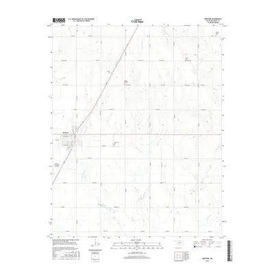
2016 Map of Medford
USGS Topo · Published 2016About this map
The Grant County seat of Medford serves as the central hub of this northern Oklahoma prairie landscape. A network of section-line roads like Johnston Rd and Jefferson Rd crisscrosses the terrain, framing a productive agricultural region defined by its drainage basins. Waterways such as Bullwacker Cr, Cottonwood Cr, and Polecat Cr meander through the fields, following the natural contours of the land.
Find a feature on this map
54 named features on this map. Tap any name to fly to it.
Don’t see what you’re looking for? This feature index may not catch every label — zoom into the map to look around manually.
Map Details
Editions of this 2016 Medford Map
This is the sole edition of this map. No revisions or reprints were ever made.
Other maps of this area

1955 · Enid
USGS Topo · 1:250,000

1958 · Enid
USGS Topo · 1:250,000

1968 · Lamont NW
USGS Topo · 1:24,000

1968 · Deer Creek
USGS Topo · 1:24,000

1968 · Wakita SE
USGS Topo · 1:24,000

1968 · Renfrow
USGS Topo · 1:24,000

1968 · Medford
USGS Topo · 1:24,000

1968 · Lamont
USGS Topo · 1:24,000
1968 · Medford NE
USGS Topo · 1:24,000

1968 · Pond Creek
USGS Topo · 1:24,000