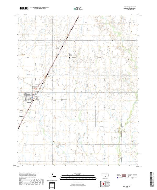
2022 Map of Medford
USGS Topo · Published 2022About this map
The Grant County Courthouse stands as the central landmark of Medford, the county seat of Grant County, Oklahoma. This prairie landscape is defined by its rigorous section-line road grid and the meandering paths of several drainage systems, including Bullwacker Cr, Cottonwood Cr, and Polecat Cr. The map reveals a high concentration of small rural cemeteries that speak to the area’s early settler history and diverse cultural heritage, such as the Czecko Slovak Cem, Tureck Cem, and the Medford Mennonite Cem. Beyond the city limits, the landscape remains largely agricultural, punctuated by Rosemound Cem and the Medford Municipal Airport to the west. This survey provides a precise view of the rural infrastructure and civic layout of North Central Oklahoma.
Find a feature on this map
57 named features on this map. Tap any name to fly to it.
Don’t see what you’re looking for? This feature index may not catch every label — zoom into the map to look around manually.
Map Details
Editions of this 2022 Medford Map
This is the sole edition of this map. No revisions or reprints were ever made.
Other maps of this area

1955 · Enid
USGS Topo · 1:250,000

1958 · Enid
USGS Topo · 1:250,000

1968 · Lamont NW
USGS Topo · 1:24,000

1968 · Deer Creek
USGS Topo · 1:24,000

1968 · Wakita SE
USGS Topo · 1:24,000

1968 · Renfrow
USGS Topo · 1:24,000

1968 · Medford
USGS Topo · 1:24,000

1968 · Lamont
USGS Topo · 1:24,000
1968 · Medford NE
USGS Topo · 1:24,000

1968 · Pond Creek
USGS Topo · 1:24,000